 |
| BIM Software |
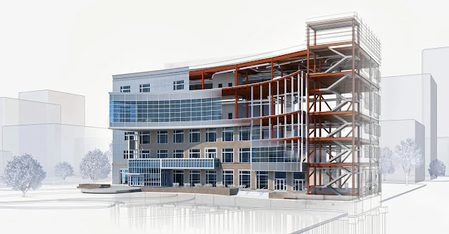
The Building Information Modeling (BIM) provides the 3D object library of the physical building. In essence, BIM is a way to construct building virtually, before building in the real world. While it has its root in architecture, the principles of BIM apply to everything that is built, including roads and highways, and the benefits of BIM are being experienced by Civil Engineers in the same way they enjoyed by Architects.
The use of powerful Building Information Modeling (BIM) for Infrastructure tools even at the conceptual design stage allows infrastructure designers to map out a variety of schemes from the outset to maximize land usage and at the same time minimize environmental impact across the range of Civil Engineering disciplines, including Road, Rail, Utilities, and GIS. BIM allows engineers more easily to predict the performance of the project before they are built, respond to design changes faster, optimize designs with analysis, simulation, and visualization, and also deliver high-quality documents. The most immediate benefits of BIM are for the road and highway projects and it is particularly important for transportation agencies because it can shorten the time to contract to let, resulting in projects being complete sooner and within more predictable timetables.
By investing in BIM for infrastructure civil engineering businesses will be able to increase the efficiency and profitability within the company as well as being more competitive in the marketplace. And at many places for completing projects, fast BIM will no doubt be the first call for supply.
BIM expands significantly the design decision matrix, facilitating collaboration among the various disciplines and systems, identifying clashes before construction begins. Also the design and construction teams, modeling can greatly aid owners in managing projects through their useful life.
I would say this is one of the best articles I’ve read. From beginning to end you nailed it totally. To write this you might have worked hard for research. Thanks for sharing this good article.Structural engineering services
ReplyDeleteThank You so much, means alot to me.
Delete